Converting open access map data to FBS-networks
Creating new FBS-networks based on open-source data – easier than ever
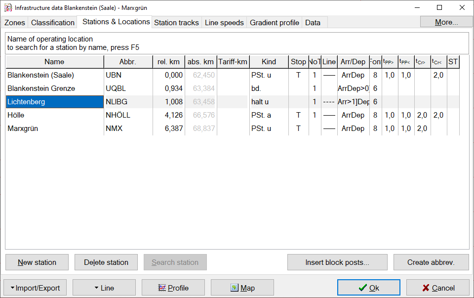
By means of our new OpenStreetMap (OSM)-converter we can quickly and easily gather infrastructure data for FBS-networks from open-source map data, which can then be used for timetable construction. This works for railway systems all around the globe. In theory (and practice) the whole railway network of a country can be imported and used.

Converting disused or deconstructed lines
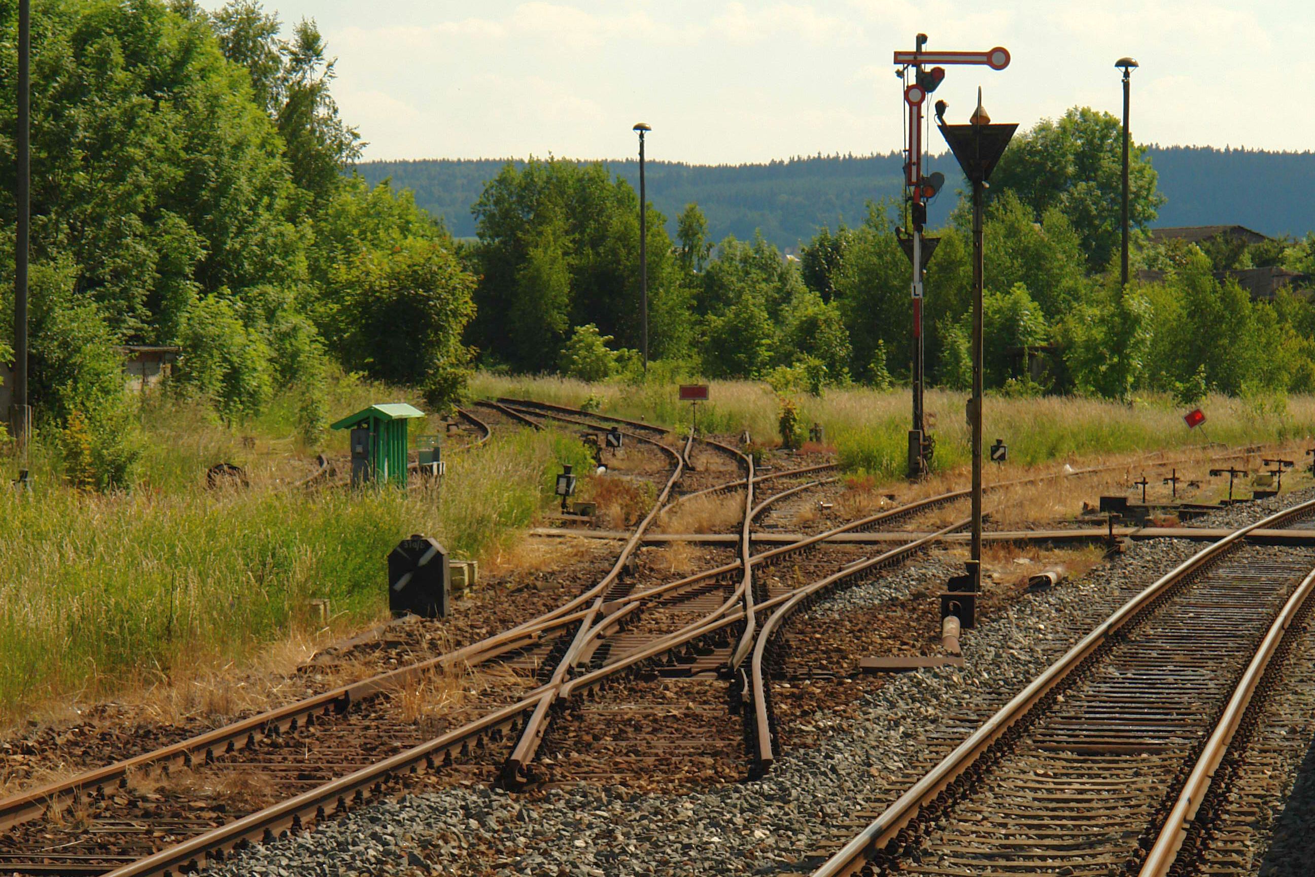
Since data of disused or even deconstructed lines is often entered into OSM, these lines can also be converted into FBS-infrastructure models. This is especially helpful, when analysing potential reactivations of lines, where infrastructure data is needed for scheduling, as there are rarely any possibilities to acquire such needed information quickly. The allowed line speeds can then be extrapolated from historic draft speeds.
Even tram lines etc. may be converted. The possibilities are essentially endless. The limitations are more about the practicability of a conversion.
Map display of lines in FBS
All line data that was created using the converter has access to a map display in FBS, that can be shown via the corresponding button (in a graphic timetable: infrastructure data (Alt + S) --> Map). It is also possible to add the map display to already existing FBS-files. The visualisation of the track layout helps at gaining a quick overview about how it fits into the landscape and where certain FBS-infrastructure points like stations, curves or gradient changes are located. This can be used for example to detect narrow curves when planning to increase the allowed line speed and making realistic assumptions about needed upgrades.
Disclaimer: The general license terms of the data provider apply.

Summary of the converter’s capabilities
|